Visuals
Visuals
Photographs and diagrams you can actually see, plus the photo and video collections we hold as records but have not copied as files. U.S. government stills are public domain. One frame is used under CC BY 2.0, with the photographer named.
People graph
Cited links between people and organisations. Proximity is not criminality.
Visual brief
Quality, fusion, and timeline charts from the same objects.
On this page
9 photographs
1 diagrams · 6 catalogue records
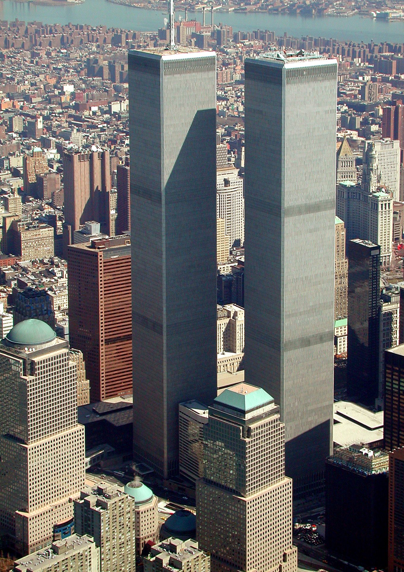
March 2001
World Trade Center from the air, March 2001
The original WTC complex standing, looking north-east over lower Manhattan, six months before the attacks.
Jeffmock · Public domain · Lower Manhattan
Source on Wikimedia Commons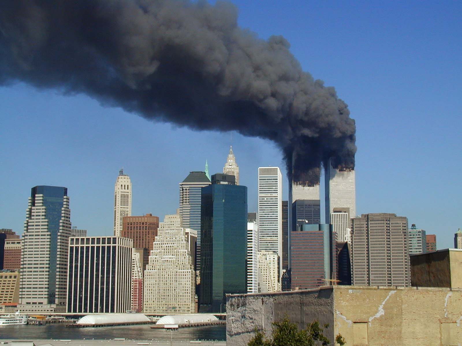
11 September 2001
Smoke from both towers, 11 September 2001
Plumes of smoke from WTC 1 and WTC 2 after each tower was struck by a Boeing 767.
Michael Foran · CC BY 2.0 · Lower Manhattan
Source on Wikimedia Commons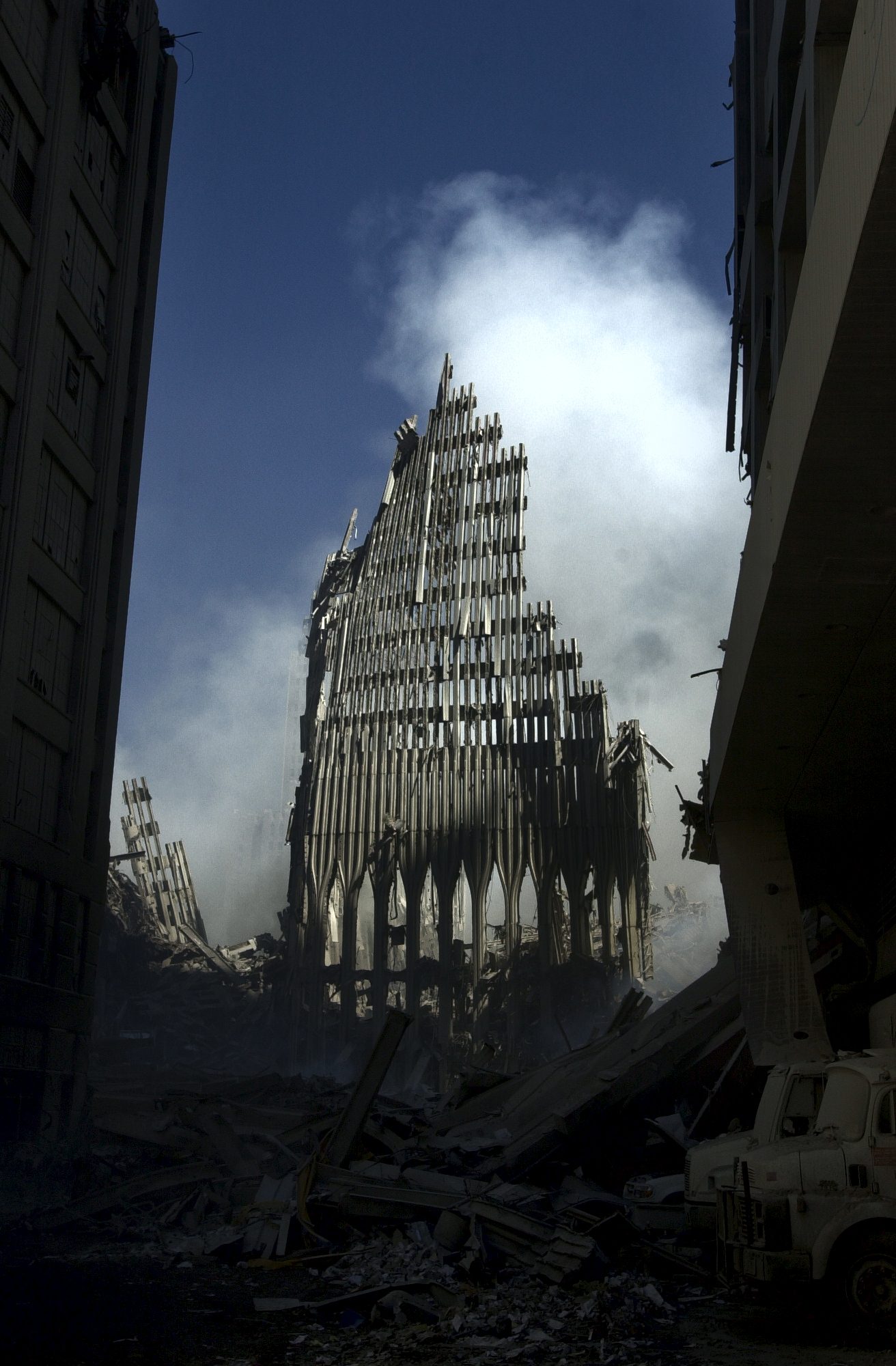
14 September 2001
What remained of the south tower, 14 September 2001
Standing remnant of WTC 2 among the debris, three days after the attacks.
Journalist 1st Class Preston Keres, U.S. Navy · Public domain · Ground Zero, New York
Source on Wikimedia Commons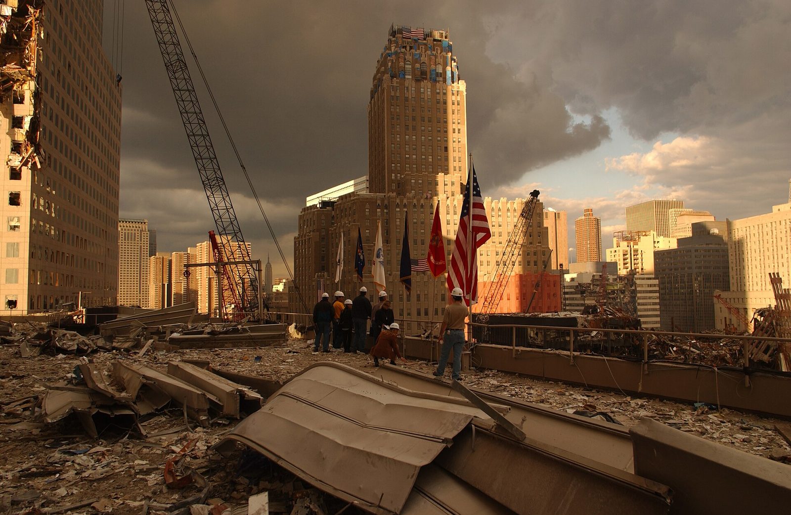
28 September 2001
Debris on neighbouring roofs, 28 September 2001
Debris thrown onto surrounding roofs at the World Trade Center site.
Andrea Booher / FEMA · Public domain · Ground Zero, New York
Source on Wikimedia Commons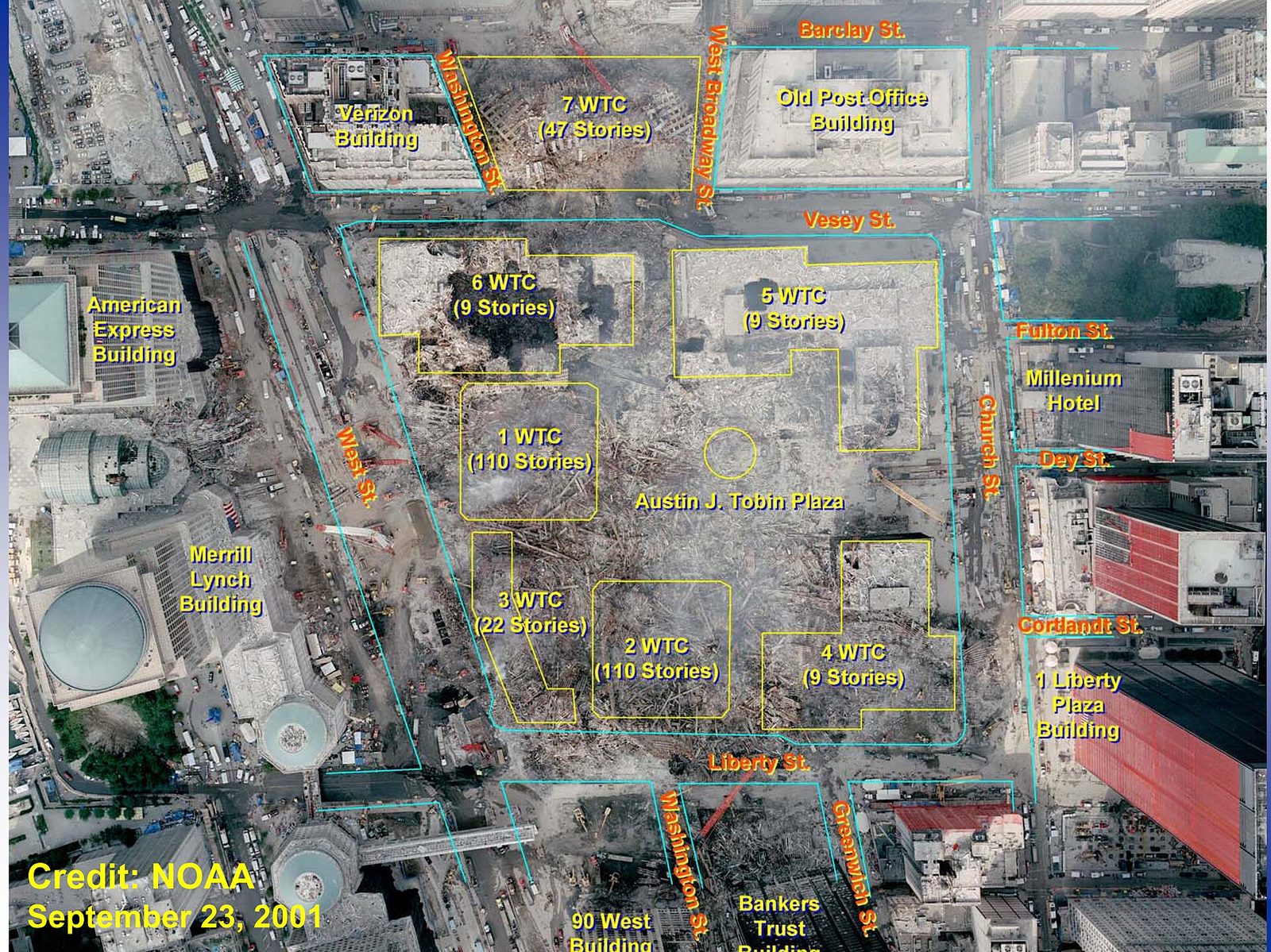
23 September 2001 (photo) / NIST overlay
Ground Zero with original building outlines
The WTC site after the attacks, with the original footprints of the buildings marked.
NOAA photograph, NIST overlay · Public domain · Ground Zero, New York
Source on Wikimedia Commons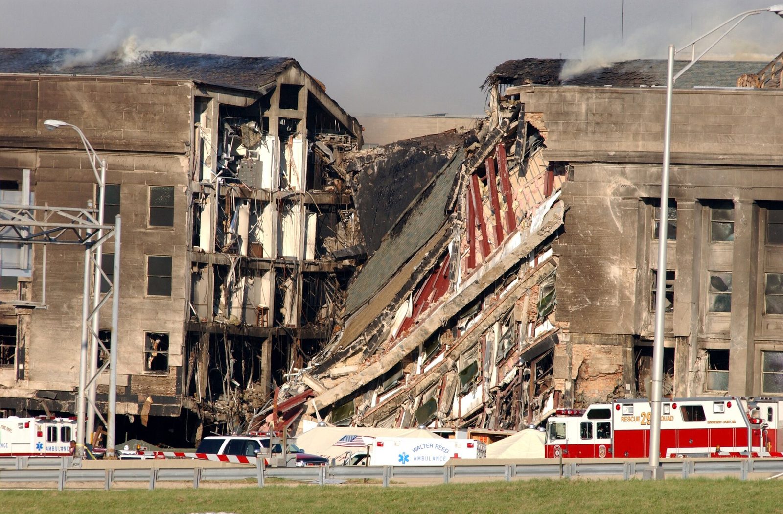
11 September 2001
Pentagon west wall, 11 September 2001
A roughly 200-foot opening in the southwest face of the Pentagon after American Airlines Flight 77 struck the building.
Photographer's Mate 2nd Class Bob Houlihan, U.S. Navy · Public domain · Arlington, Virginia
Source on Wikimedia Commons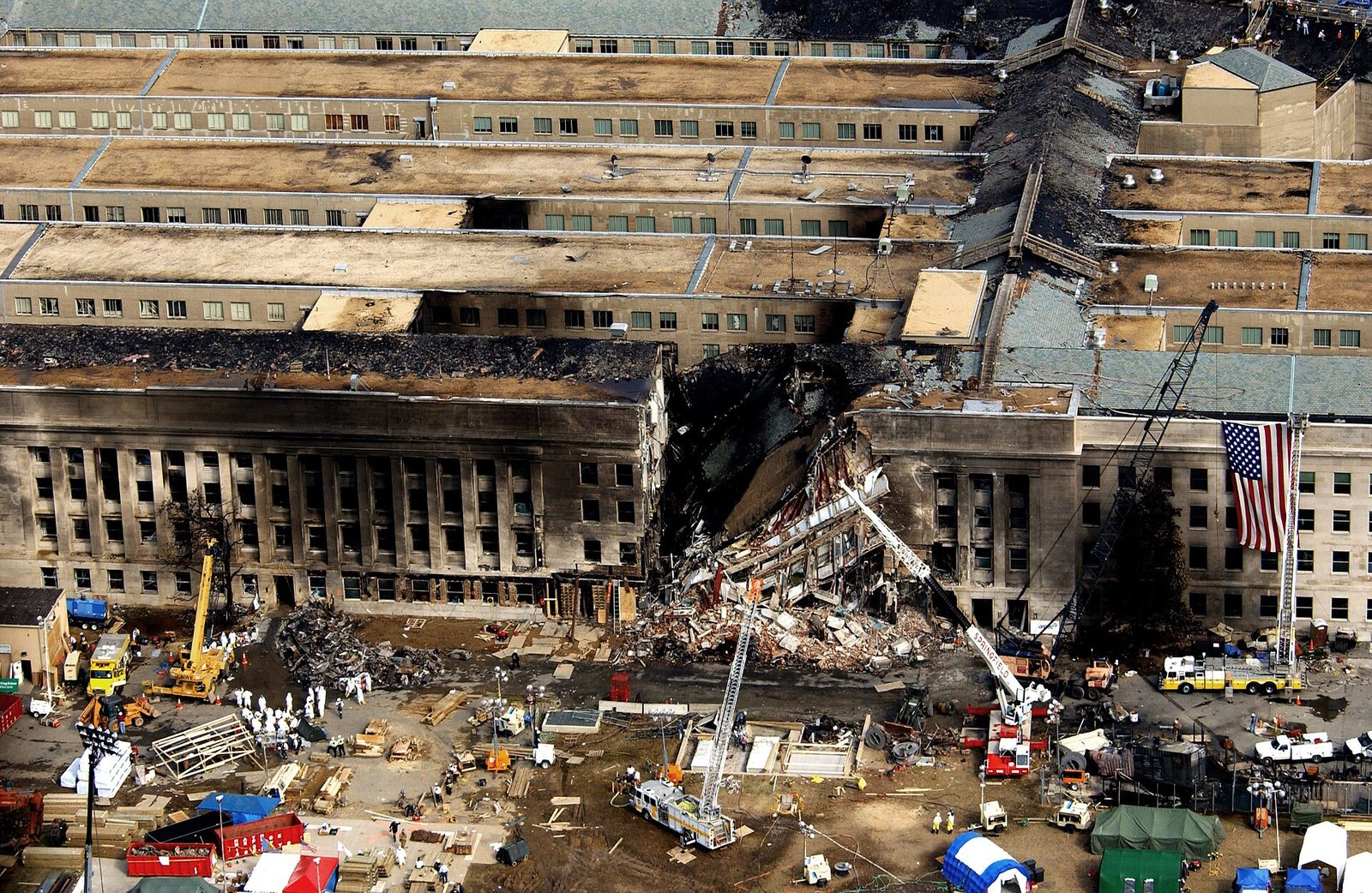
14 September 2001
Aerial view of the Pentagon during rescue
Aerial view of emergency crews at the Pentagon after the crash into the southwest corner.
TSgt Cedric H. Rudisill, USAF · Public domain · Arlington, Virginia
Source on Wikimedia Commons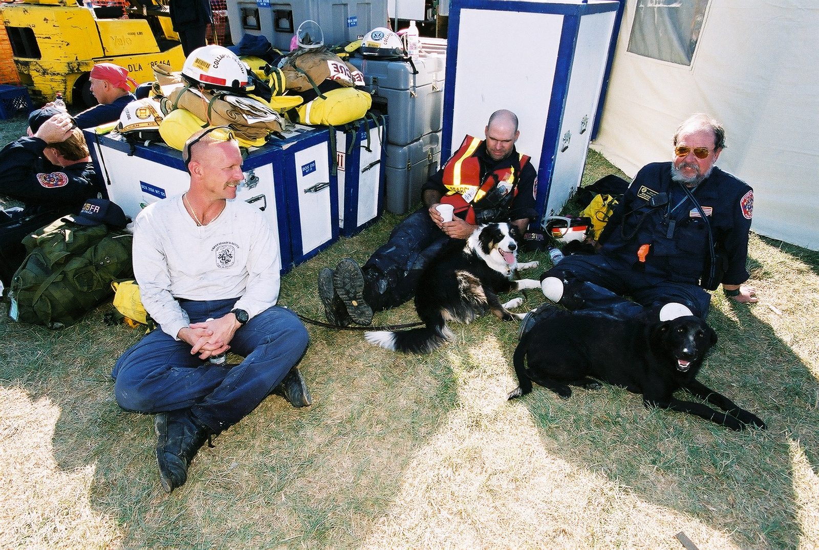
12 September 2001
Urban search and rescue at the Pentagon, 12 September 2001
Urban Search and Rescue teams and dogs waiting to be sent into the Pentagon crash site.
Jocelyn Augustino / FEMA · Public domain · Arlington, Virginia
Source on Wikimedia Commons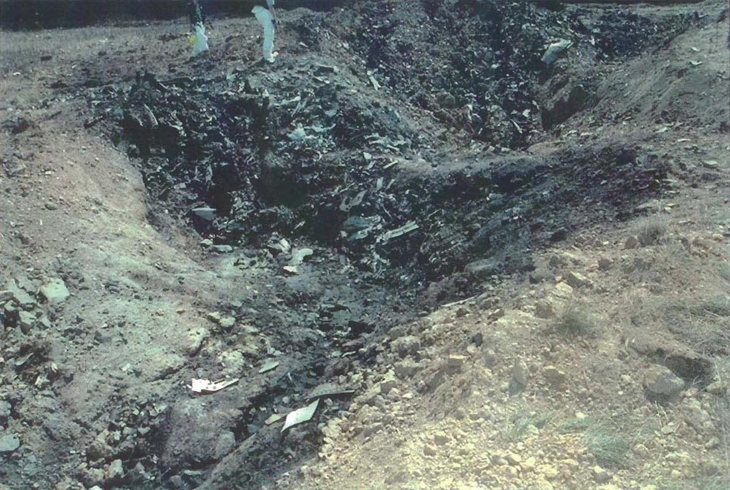
11 September 2001
United Airlines Flight 93 crash site
The impact site in Somerset County, Pennsylvania, where United Airlines Flight 93 came down.
U.S. government · Public domain · Somerset County, Pennsylvania
Source on Wikimedia Commons